Table of Contents
Ancient Desert Navigation and the Wisdom of the Shifting Sands
Ancient Desert Navigation was an art form perfected over millennia by the nomadic tribes of the Arabian Peninsula. Long before the invention of satellite technology or digital maps, travelers relied on a sophisticated understanding of the natural world to survive. The desert is a place of constant change, where a sandstorm can erase a trail in minutes.
Surviving in such an environment required more than just physical strength; it required mental mapping and acute observation. The ability to read the sky, the sand, and the behavior of animals was the difference between reaching an oasis and becoming lost in the vast expanse. Every ripple in the dune held a message for the trained eye.
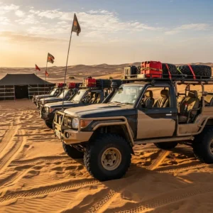
Today, when we visit the dunes through services like https://htdesertsafari.com/, we often take for granted how easily we navigate these spaces. However, the history of how people moved through this landscape is filled with brilliant insights. It is a story of human resilience and the deep connection between man and nature.
Celestial Guiding Tools and the Power of the Night Sky
The most reliable tool in Ancient Desert Navigation was the night sky. In the clear, unpolluted atmosphere of the desert, the stars appear with a brilliance that is hard to imagine in modern cities. Nomads used the stars not just as decorations, but as a complex grid of coordinates.
The North Star, or Polaris, was the primary reference point because it remains virtually fixed in the sky. By locating this star, travelers could always determine where true north lay. This allowed them to maintain a consistent heading even when the terrain offered no landmarks.
Different tribes had their own names and stories for various constellations. These stories served as mnemonic devices, helping younger generations memorize the positions of the stars throughout the changing seasons. The movement of the Pleiades or the rising of Sirius signaled the coming of rains or the change in temperature.
Understanding Desert Wind Patterns and Dune Structure
Wind is the architect of the desert, and in Ancient Desert Navigation, it served as a directional compass. The prevailing winds in the Arabian desert usually follow specific seasonal patterns. By feeling the wind on their face or observing the way it carved the sand, nomads could determine their orientation.
Dunes are not random piles of sand; they have a “windward” side and a “leeward” side. The windward side is a gentle slope, while the leeward side is a steep drop. An expert navigator could look at the shape of a dune from a distance and know exactly which direction the wind had been blowing from for the past several days.
Even during a sandstorm when the sky was obscured, the “ripple marks” on the surface of the sand provided clues. These ripples always form perpendicular to the wind direction. By keeping these ripples at a specific angle to their path, travelers could maintain a straight line through the haze.
The Role of Animal Tracking and Wildlife Behavior
Animals are naturally attuned to the desert’s secrets, and Ancient Desert Navigation often involved following the “experts.” If a traveler saw a desert fox or a gazelle moving with purpose, they were likely heading toward a water source or a sheltered area.
Birds were particularly important. Certain species of birds fly toward water at sunset. By watching the flight paths of these birds, nomads could locate hidden oases that were tucked away between massive dunes. This bio-navigation was an essential part of the nomadic toolkit.
Camels also played a huge role. These animals have an incredible sense of smell and can detect water from kilometers away. A seasoned traveler would often let their camel lead the way if they suspected they were nearing a watering hole. The camel’s instinct was often more accurate than human judgment in the heat of the day.
Sun Shadow Plotting and Daytime Orientation
During the day, the sun was the primary guide for Ancient Desert Navigation. However, looking directly at the sun is dangerous and inaccurate. Instead, nomads used the shadows. By sticking a staff into the ground and marking the tip of the shadow at different intervals, they could determine a perfect east-west line.
This method, known as the “shadow stick” technique, is one of the oldest forms of surveying. It allowed caravan leaders to correct their course at noon when the sun was at its highest point. Even without a stick, the angle of the sun against the ridges of the dunes provided a rough idea of the time and direction.
Heat haze and mirages often made daytime travel difficult. To combat this, navigators would often look “low” to the ground to see the true horizon or wait until the sun was lower to get a clearer view of distant landmarks. Patience was as much a part of navigation as any technical skill.
| Navigation Method | Primary Element | Reliability |
| Stellar Tracking | Polaris / Constellations | Very High |
| Wind Mapping | Dune Ripples / Slopes | Medium |
| Shadow Plotting | Sun Position | High |
| Bio-Navigation | Bird Flight / Animal Tracks | Medium |
Traditional Desert Routes and Landmark Memory
While the sand moves, some features of the desert remain constant. In Ancient Desert Navigation, rocky outcrops, specific dried-up riverbeds (wadis), and unique gravel plains served as vital milestones. Navigators had to possess an incredible memory for shapes and textures.
Caravan routes were often passed down from father to son through oral traditions and poems. These poems would describe the journey in detail: “Turn where the black rocks meet the red sand, and walk until you see the tree with the twisted trunk.” This verbal mapping turned a featureless desert into a structured path.
External sites like https://dubaidesertsafarie.com/ often discuss the heritage of these routes. When you travel today with https://royaldesertadventures.ae/, you are often following the same ancient paths that were used by frankincense and spice traders thousands of years ago. These routes were chosen because they offered the best balance of safety and access to water.
The Science of Sand Color and Texture
Not all sand is created equal. An expert in Ancient Desert Navigation could tell where they were simply by looking at the color and grain size of the sand. The red sands of the interior are different from the white sands of the coast or the dark, gravelly sands of the mountain foothills.
The texture of the sand also told a story. Fine, “singing” sands indicated a specific wind-swept environment, while heavy, crusted sand suggested that moisture had recently been present. By picking up a handful of sand and feeling its weight and grit, a nomad could narrow down their location within a large territory.
This tactile navigation was especially useful during the “blue hour” of twilight when shadows disappear and the landscape becomes flat and monochromatic. Feeling the earth beneath one’s feet provided the sensory input needed to stay on the right path.
Water Sourcing and Moisture Indicators
Finding water was the ultimate goal of Ancient Desert Navigation. Navigators looked for specific vegetation like the “ghaf” tree, which has roots that can reach deep into the water table. If you see a cluster of green in the distance, it is a sign that life-sustaining water is nearby.
They also looked for “salt flats” or sabkhas. While the water in a sabkha is often too salty to drink, it indicates that the water table is very close to the surface. In emergencies, nomads would dig in the low points between dunes, hoping to tap into the moisture held within the sand.
Understanding the “dew point” was another secret. In the early morning, moisture condenses on rocks and certain plants. While not enough for a large caravan, this “desert nectar” could sustain a lone traveler. Knowing which plants captured the most dew was a vital survival secret.
The Importance of the “Desert Sense”
There is a psychological aspect to Ancient Desert Navigation that modern science is still trying to understand. Many nomadic people developed a “sixth sense” for direction. This wasn’t magic; it was the result of the brain constantly processing thousands of tiny environmental cues subconsciously.
A navigator would notice a slight change in the smell of the air, a shift in the temperature, or a subtle change in the sound of the wind. These clues would signal that they were approaching the sea or a mountain range long before the feature became visible.
This total immersion in the environment is something that is rarely experienced today. When you go on a tour with https://saharadesertsafaridubai.com, the guides often try to share a bit of this “desert sense” by encouraging guests to listen to the silence and observe the small details of the dunes.
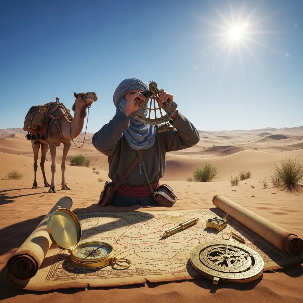
Celestial Instruments Before the Modern Era
While many nomads relied on the naked eye, some early civilizations developed basic tools for Ancient Desert Navigation. The astrolabe and the quadrant were used by Arab scholars and explorers to measure the altitude of stars.
These instruments allowed for much more precise latitude calculations. While the average tribesman might not carry an astrolabe, the leaders of large trade caravans often did. This marriage of traditional nomadic knowledge and early scientific instrumentation allowed for the expansion of trade across the entire “Empty Quarter.”
The “Kamal” was another simple but effective tool. It was a small wooden board with a string. By holding the board at a certain distance and aligning it with the horizon and a star, travelers could determine their latitude. It was the precursor to the modern sextant and a masterpiece of ancient engineering.
Weather Forecasting Without Technology
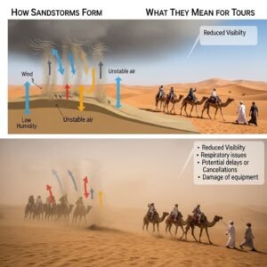
In the desert, the weather can be a friend or a deadly enemy. Ancient Desert Navigation included the ability to predict sandstorms and rain. A sudden drop in air pressure, a change in the color of the sunset, or the behavior of insects were all used as early warning signs.
If ants were seen moving their eggs to higher ground, it was a sure sign of coming rain. If the wind suddenly died down and the air felt “heavy,” a major sandstorm was likely on its way. Knowing when to stop and find shelter was just as important as knowing which way to walk.
Navigators would often look for “haloes” around the moon, which indicated moisture in the upper atmosphere. This foresight allowed caravans to secure their supplies and protect their animals before the environment turned hostile.
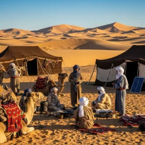
The Social Structure of Navigation
Navigation was rarely a solo endeavor. In Ancient Desert Navigation, the responsibility was shared. The “Dalil” was the lead navigator, a person of high status who held the collective map of the tribe in their head.
Younger men would act as scouts, riding ahead to verify landmarks and report back. This social system ensured that knowledge was verified and that the group remained cohesive. Mistakes were corrected through consensus and the comparison of observations among the elders.
This tradition of shared knowledge is still seen in the way local guides operate today. When you book through https://royaldesertadventures.ae/, you aren’t just getting one person’s knowledge; you are benefiting from a legacy of information that has been refined over centuries.
The Impact of Night Travel on Orientation
To avoid the scorching sun, much of the Ancient Desert Navigation happened at night. This changed the way people perceived the landscape. At night, the desert is a world of silhouettes and sounds.
Navigators learned to recognize the profiles of mountains against the starlight. They also used sound—the way the wind whistled through a certain rock formation or the sound of shifting sand—as a secondary navigational aid. Acoustic mapping was a vital, though often overlooked, part of the process.
Night travel also required a keen sense of “pacing.” Without visual landmarks to judge distance, travelers counted their steps or the rhythmic strides of their camels to estimate how far they had traveled. Time and distance were measured in breaths and heartbeats.
Navigation and the Preservation of Culture
The skills of Ancient Desert Navigation are deeply woven into the poetry and music of the region. Many traditional songs are actually “road maps” set to music. The rhythm of the song matches the gait of a walking camel, helping the traveler keep a steady pace.
By preserving these songs, the tribes preserved their survival skills. Even today, during cultural festivals in the UAE, you can hear the echoes of these navigational chants. They serve as a reminder of a time when the human mind was the most powerful computer in the world.
Modern travelers can learn more about this heritage through resources like https://htdesertsafari.com/. Understanding the history of the land makes the modern safari experience much more meaningful. It connects the high-tech present with the ingenious past.
The Transition to Modern Mapping
The arrival of the compass and eventually the GPS changed Ancient Desert Navigation forever. While these tools are more accurate and easier to use, something was lost in the transition. The deep, intuitive connection to the land began to fade.
However, many professional desert guides in Dubai still study the ancient ways. They know that batteries can fail and signals can be lost. In those moments, the stars and the wind are the only things you can count on. The ancient methods remain the ultimate backup system for anyone venturing deep into the dunes.
Today’s technology allows us to map the desert with centimeter-level precision, but it cannot replicate the feeling of “knowing” the desert. The blend of old and new is what makes modern exploration so fascinating. We use satellites to find the path, but we use ancient wisdom to understand the journey.
Desert Navigation as a Form of Art
If you look at Ancient Desert Navigation as a science, you see the logic. If you look at it as an art, you see the beauty. It is the art of seeing what is invisible to others. It is the ability to find a path where most see only chaos.
For the Bedouin, the desert was not a void; it was a home with many rooms and corridors. They moved through it with the confidence of a person walking through their own house in the dark. This mastery of the environment is one of the greatest achievements of human culture.
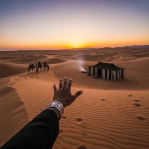
When you stand on top of a red dune today, try to imagine doing it without your phone. Look at the ripples in the sand and the position of the sun. For a brief moment, you can step into the shoes of the ancient navigators and feel the immense power of the shifting sands.
Lessons for Modern Travelers
What can we learn from Ancient Desert Navigation? First, it teaches us the importance of observation. In our fast-paced world, we often forget to look at the details. The desert rewards those who pay attention.
Second, it teaches us respect for the environment. The nomads didn’t try to conquer the desert; they worked with it. They understood its rhythms and its rules. This philosophy of “living with the land” is more relevant today than ever as we face global environmental challenges.
Finally, it teaches us about human potential. Our ancestors did things with their minds that we now delegate to machines. By studying their methods, we rediscover our own capacity for problem-solving and resilience. The desert is the ultimate teacher, and its lessons are written in the stars and the sand.
The Role of Sandstorms in Navigation
Sandstorms are the greatest challenge to Ancient Desert Navigation. A severe storm can change the height of a dune by several meters or move it entirely. During these times, the physical map of the desert is literally rewritten.
Navigators had to know when to stop and wait. Trying to navigate during a storm was a death sentence. They would position their camels in a circle to create a windbreak and hunker down until the air cleared. Once the storm passed, they would have to “re-calibrate” their position by finding the stars or a fixed rocky landmark.
The ability to remain calm in a changing landscape is a core tenet of desert wisdom. It is about trusting your training and your instincts even when the world around you is in flux. This mental toughness is the legacy of the desert people.
Conclusion: The Timeless Path
Ancient Desert Navigation is not just a relic of the past; it is a testament to the enduring spirit of exploration. The methods used by the nomads are a bridge across time, connecting us to the generations who first called the dunes their home.
Whether you are exploring the desert on a luxury safari or studying its history from afar, the stories of the ancient navigators offer a unique perspective. They remind us that the world is full of hidden signs and that the most important tool we have is our own awareness.
As we move forward into a future of even more advanced technology, let us not forget the stars, the wind, and the sand. They were our first guides, and they still have much to teach us. The path through the desert is always there; we just have to know how to look for it.
Frequently Asked Questions
How did nomads find water without a map?
Nomads used biological indicators like the presence of “ghaf” trees and the flight paths of birds at sunset to locate water. They also looked for salt flats (sabkhas), which indicate a high water table.
Can you really navigate by the stars?
Yes. The North Star (Polaris) remains fixed in the sky, providing a constant reference for north. Other constellations were used to determine the season and time of night.
What is a “shadow stick” and how does it work?
A shadow stick is a staff placed in the ground. By marking the end of its shadow at different times, travelers could determine a perfect east-west line for daytime orientation.
Do sand dunes move?
Yes, dunes are “living” structures that move with the wind. This made permanent maps impossible and required navigators to rely on stars and fixed rocky landmarks instead.
What is “bio-navigation”?
Bio-navigation is the practice of using animal behavior to find direction or resources. In the desert, this meant following bird flight paths or animal tracks to find water and shelter.
How did caravan leaders communicate routes?
Routes were often preserved in oral traditions, poems, and songs. These mnemonic devices helped travelers remember complex directions and landmarks over long distances.
What is an astrolabe?
An astrolabe is an ancient astronomical instrument used to measure the altitude of stars and planets. It was used by Arab scholars to calculate latitude and time.
How did wind help with direction?
Prevailing winds create predictable patterns on the sand. The steep side of a dune (leeward) and the gentle side (windward) always face specific directions relative to the wind.
Is it possible to get lost even with ancient skills?
Yes. The desert is unforgiving. Major sandstorms or extreme heat could disorient even the most experienced “Dalil” or lead navigator.
Why was night travel preferred?
Night travel allowed the group to avoid the extreme heat of the sun and provided the clearest view of the stars, which were the most reliable navigational aids.
What role did camels play in navigation?
Camels have an excellent sense of smell and a natural instinct for finding water. They were often allowed to lead the way when the caravan was low on supplies.
How were distances measured?
Distances were often measured by time—how many “marches” or days it took to travel between two known points. Pacing and the rhythm of songs also helped estimate distance.
What are “singing sands”?
Singing sands are dunes that produce a low-frequency hum when the sand moves. These were used as acoustic landmarks by navigators who recognized the unique sounds of certain areas.
How did nomads predict sandstorms?
They watched for changes in air pressure, the color of the horizon, and the behavior of animals like ants or birds, which become restless before a storm.
What is a “Kamal”?
A Kamal is a simple wooden tool used with a string to measure the height of stars above the horizon. It helped ancient mariners and desert travelers determine their latitude.
Can modern travelers learn these skills?
Yes, many desert survival courses and cultural tours in Dubai offer introductions to traditional navigation techniques.
Why is sand color different in different areas?
Sand color is determined by the mineral content and the age of the dunes. Iron oxide creates red sand, while crushed shells and coral create white coastal sand.
What is the “North Star” called in Arabic?
In Arabic, the North Star is often referred to as “Al-Jedi,” and it has been a central part of Arabian astronomical tradition for centuries.
How did travelers stay cool while navigating?
They used loose-fitting wool or cotton clothing to insulate against the heat and traveled mostly during the dawn, dusk, and night hours.
Is ancient navigation still used today?
While GPS is the primary tool, many professional desert guides still use traditional skills as a backup and to provide a more authentic experience for tourists.
The legacy of Ancient Desert Navigation is a treasure that belongs to all of us. It is a story of how we found our way in a world without screens or satellites. By understanding these methods, we gain a deeper appreciation for the history of the Arabian desert and the people who mastered it.
The dunes of Dubai are more than just a place for adventure; they are a library of ancient wisdom. Every grain of sand has a story, and every star in the sky is a guide. When you next visit the desert, take a moment to look up and look around. The path is there, waiting to be discovered.
Trust in the wisdom of the past to enhance your journey in the present. The desert is a place of infinite wonder, and with the right perspective, you will never truly be lost. Experience the magic of the sands with the respect and curiosity of the ancient nomads.
Would you like me to create a specific guide on how to use the “shadow stick” method for your next desert excursion?